Taunus Hike
Day 2: Glashütten to Idstein
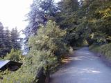
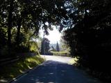
7/3/01, 9:50 a.m., Hasenmühle. I'm sitting on a bench overlooking a "Naturschutzbereich" (nature protection area), one of many in this part of Germany. I left the hotel at 7:30 this morning. Had some trouble finding the route-you have to go alongside the highway leading out of town (to Königstein), then go down an incline to the street "Im Wiesengrund". Coming into town from the trail there are 3 hotels a few blocks from each other on the main highway (B8-Limburger Straße). Once you get on the trail it is a beautiful short hike to the small town of Schloßborn. The trail takes you through town and then on to a logging road through the woods. No stores or restaurants along the trail, but probably both in the town.
It's a good idea when going on this trail to study the map regularly, and watch for landmarks, such as churches or bus stops, and also look for co-marking of the trail with symbols for other hiking trails. Often the local trails are better marked than the long distance trails.
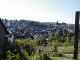
In and around Schloßborn
11:40 a.m., picnic table near Alteburg (site of former Roman fort). Stopped here for lunch-cheese and crackers and Tang. I need to find some more water; I'm running low-only have half a liter with me. I got lost a bit this morning. Just after the Schinderhannes Oak (one of several named trees, such as the Gottschalk Fir I've encountered-this one blew down in a storm in 1975), the trail emerged from the woods and continued straight, it seemed. But after a while I noticed there were no more trail markers. I retraced my route back and took the path going off sharp right after the woods, again no signs. Tried right on a path between woods and the field, which petered out after 10 minutes. Went back and studied the map some more and finally just started crossing the field where the map indicated the trail should be. Sure enough, after a few minutes, there was a marker on a power line tower. Not much of a path. I probably added 2 or 3 kilometers to my total trying alternate routes.

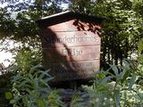
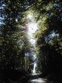
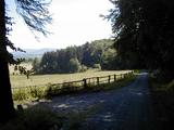
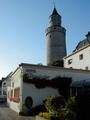
Alteburg picnic - Schinderhannes Oak - Trail pics
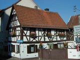
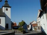
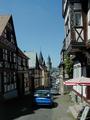
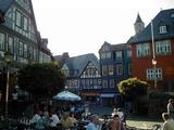
4:15 p.m., Idstein. Arrived here at around 1:00. On the outskirts of town was a swimming pool, so I paid my 3 DM 50 and had a swim. It sure was refreshing. From the pool it was a short hike into town. The town is quite nice, with a small pedestrian zone, the remains of a medieval castle (the "Hexenturm" - witch's tower - is still standing), and many "Fachwerkhäuser" (half-timbered houses) from the 17th century.
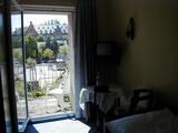
Many hotels to choose from-some looked quite expensive (3 stars). I tried one of the first modest ones I came to, as I have blisters on both feet. It's the Hotel Felsenkeller next to the Rathaus (70 DM with breakfast and west-facing balcony). Bag of gummi bears on the pillow. Friendly staff-asked how far I'd made it today and said they had folks occasionally from the E1. The hotel is less than a block from the trail, which passes right through (find the trail marker?) the middle of the old part of town.
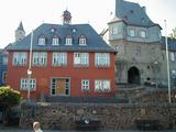
Idstein (Hexenturm - Rathaus/Torbogen - Marktplatz) - Felsenkeller Hotel
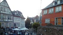
Idstein Marktplatz panorama
(in QuickTime VR - requires QuickTime plug-in)
Ate at the "Swan" Restaurant-Rumpsteak (from Argentina) for 34 DM.
Total today: 16 km (includes 2 km gettIng lost)

